
Although this beautiful pocket map of prerevolutionary Paris was produced in 1780 by the famed cartographers Jacques Esnauts and Michel Rapilly, several years after Adam Smith’s residency in the City of Lights in 1766, it gives us some idea of the extent and scale of the French metropolis during Smith’s sojourn.
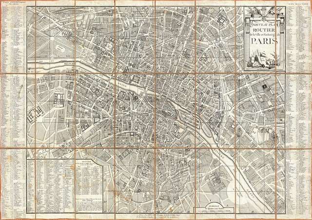
Via GetArchive (see here): “An extraordinary map of pre-Haussmann pre-Revolutionary Paris and the early Faubourgs (suburbs) issued in 1780, during the final decade of the French Monarchy. Covers Paris on both sides of the Seine from the Ecole Militaire to the Hospital de la Roquette, extends north as far as Montmartre and south roughly to Les Gobelins. Produced at the height of French dominance of the cartographic arts, this map is a masterpiece of the engraver’s art. Individual buildings, fields, streets, hills, valleys, orchards, and public gardens are revealed in breathtaking detail. We can even see the incomplete state of the northern wing of the Louvre Palace. There is an elaborate street index on either side of the map. An allegorical neoclassical title cartouche featuring war trophies appears in the upper right quadrant. This type of map, known as a pocket or case map, is designed with the traveler in mind and while it displays beautifully unfolded, is designed to fold and fit in a vest or coat pocket.”

