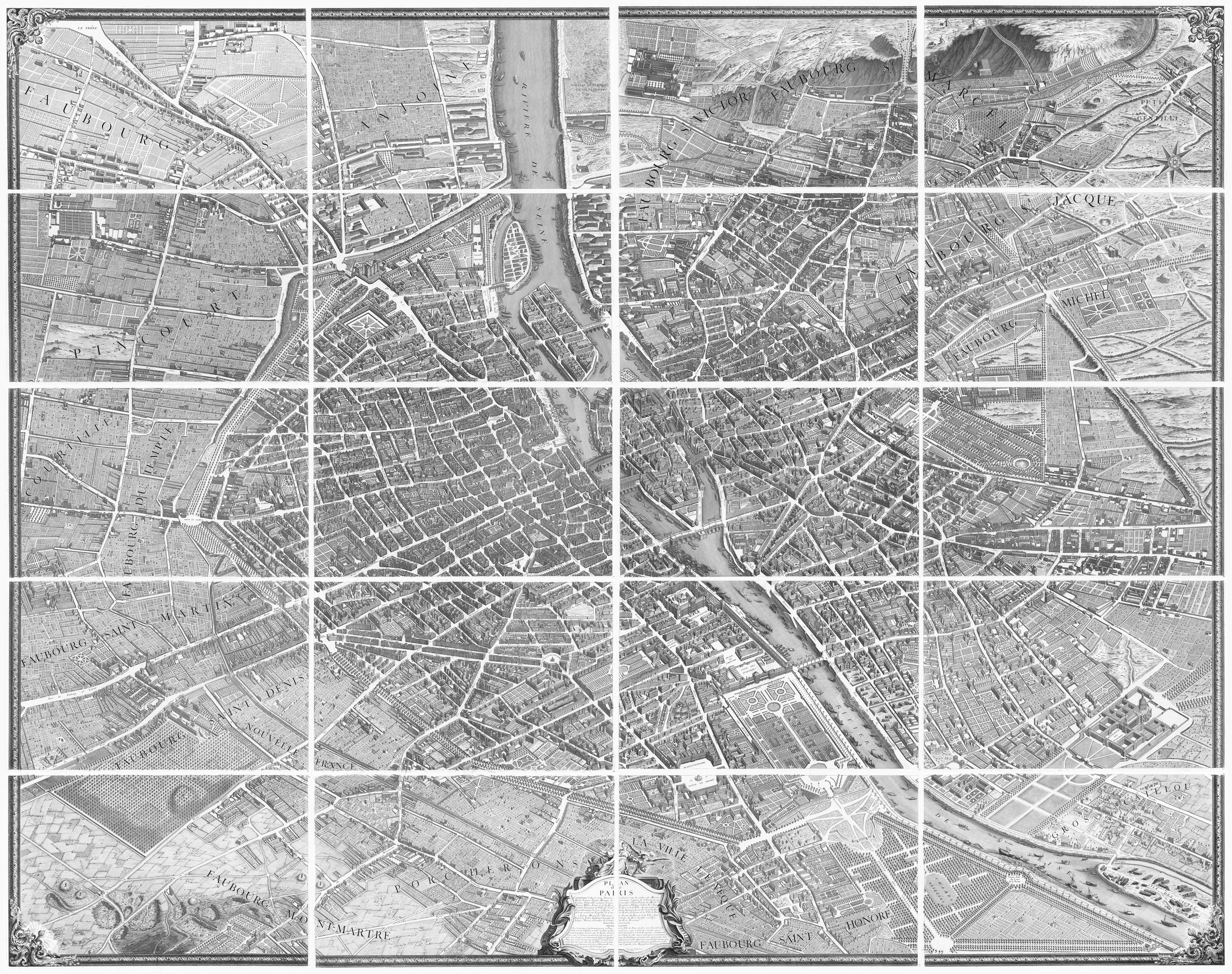
In our previous post, Alain Alcouffe and I mentioned that we would be using an 18th-century map of Paris, the Plan de Turgot (a reproduction of which is pictured below in its final assembled form), to map Adam Smith’s proximity to several of the leading salons of Paris during his sojourn in the City of Light in 1766. In the words of one historian (Philipp Blom, Enlightening the World: Encyclopédie, the Book that Changed the Course of History, Palgrave Macmillan (2005), p. 2), the Turgot map of Paris is noteworthy because it provides us “the first all-comprising graphical inventory of the capital, down to the last orchard and tree, detailing every house and naming even the most modest cul-de-sac.”
In summary, this map of the French capital is named after Michel-Étienne Turgot (1690-1751), the father of the future intendant and influential free-market économiste Anne Robert Jacques Turgot (1727-1781), who, as fate would have it, Smith would befriend in the summer of 1766. Turgot père was prévôt des marchands de Paris (master of the merchants of Paris), a position he held from 1729 to 1740, and by all accounts, he wanted to promote the reputation of Paris among Parisian, provincial, and foreign elites by commissioning a new map of the city. To this end, Turgot père appointed Louis Bretez (c.1700-1737), a professor of perspective and a member of the Académie royale de peinture et de sculpture (Royal Academy of Painting and Sculpture), in 1734 to draw up the map and even authorized him to enter public and private buildings and gardens to take measurements.
After Bretez worked on the map between 1734 and 1736, Claude Lucas (1685-1765), an engraver at the Royal Academy of Sciences, subdivided the map into a four-by-five grid with twenty non-overlapping sections and created a separate engraving for each individual section of the map. Bretez and Lucas’ work was then published in 1739 in the form of an atlas consisting of 20 non-overlapping sectionals presenting a bird’s eye view of 18th-century Paris at a scale of approximately 1:400. Among the places depicted on this detailed and meticulous map are (i) the rue du Colombier, the location of the Parisian townhouse where Adam Smith resided in 1766; (ii) the hôtel de la Rochefoucauld, the townhouse of the Duchesse d’Enville, which was located just around the corner from the Rue du Colombier; (iii) the nearby Convent Saint-Joseph, where Madame du Deffand convened her famed salon; and (iv) the Temple compound on the old rue du Temple, where the Comtesse de Boufflers and her consort, the Prince de Conti, held their sumptuous salon.
In our next few posts, Alain and I will turn to each of these four locations, beginning with Smith’s lodgings on the Rue du Colombier.